Cultural Geography
Heian-kyō
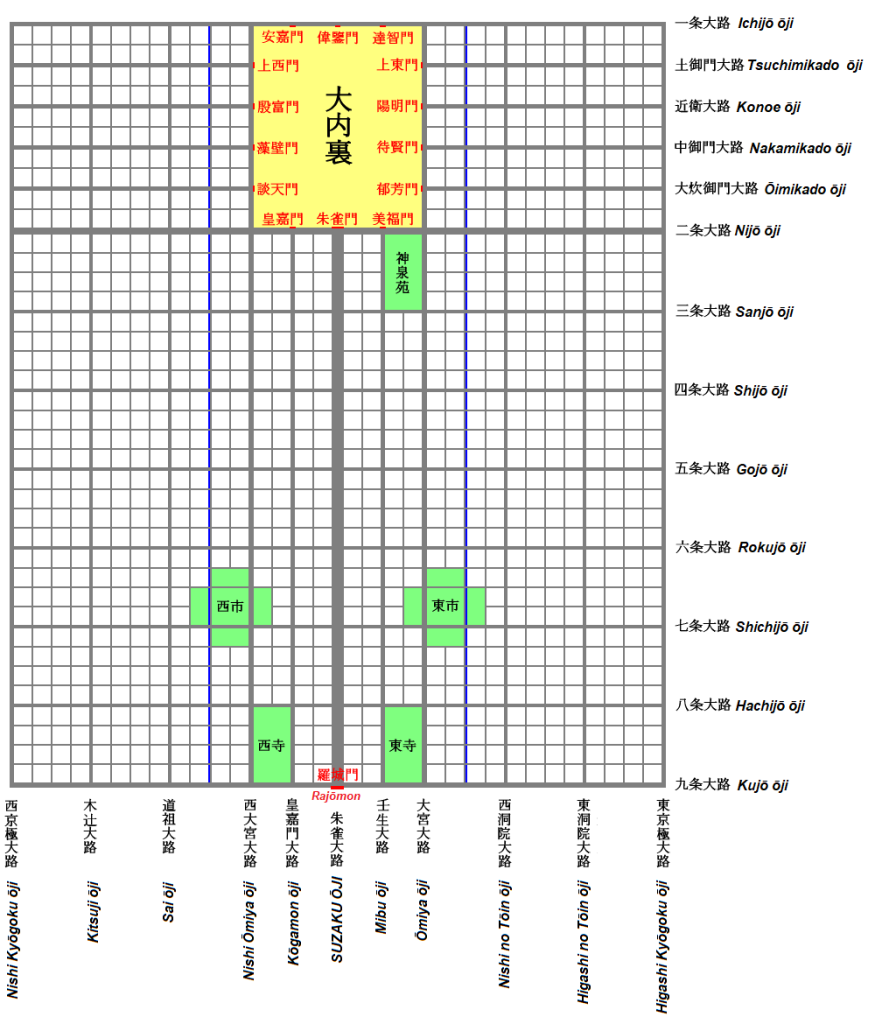
Image: Alan J. Roxx / Wikimedia Commons · CC BY-SA 4.0
Heian-kyō was the planned capital established by Emperor Kanmu in 794 in the basin of present-day Kyoto. Laid out as a rectangular grid with the imperial palace toward the north, it became the center of court government and aristocratic culture associated with the Heian period. Its avenues, wards, markets, residences, temples, and waterways did not remain static: occupation shifted eastward, fires and warfare repeatedly altered buildings, and later commercial and religious districts extended beyond the original plan. Heian-kyō is thus the historical predecessor and spatial frame of Kyoto, not a synonym for the entire modern city. Archaeological remains and reconstructed models help recover its form, but they combine surviving evidence with scholarly interpretation.
Overview
| Japanese name | 平安京 |
|---|---|
| Romanization | Heian-kyō |
| Founded | 794 |
| Founder | Emperor Kanmu |
| Location | Kyoto basin, centered in present-day Kyoto City |
| Urban form | Rectangular grid with the imperial palace in the north-central sector |
Name and foundation
Heian-kyō means “capital of peace and tranquility.” Emperor Kanmu transferred the court from Nagaoka-kyō in 794; Kyoto's official historical chronology records the imperial entry in the tenth lunar month and the naming of the city shortly afterward. The move opened the era later called the Heian period.
The foundation was a political and material project involving land survey, roads, palace and office construction, labor, taxation, and resettlement. “Founded in 794” identifies an institutional transition, not the instant completion of every planned avenue and building.
Site and grid plan
The capital occupied the Kyoto basin between river systems and surrounding mountains. Its main north–south axis, Suzaku Ōji, ran from Rajōmon at the southern edge toward the palace precinct. Smaller avenues divided the city into a regular ward system, with the right and left capitals described from the emperor's south-facing viewpoint.
The plan belongs to a lineage of East Asian capital design transmitted through earlier Japanese cities, especially Heijō-kyō and Nagaoka-kyō. Terrain, drainage, property use, and later development modified the abstract grid, so diagrams should not be mistaken for a complete picture of inhabited space.
Palace and government
The Daidairi, or greater palace enclosure, contained spaces for state ceremonies, administration, and the sovereign's residence. The Chōdō-in served formal governmental functions, while the Dairi was the inner palace. Court offices and noble households were distributed in relation to this northern center.
Political practice did not always remain inside the ideal plan. Emperors increasingly used residential palaces elsewhere in the city after fires and rebuilding delays, while aristocratic lineages, retired sovereigns, temples, and later warrior authorities created multiple centers of influence.
Residential, religious, and commercial life
Aristocratic compounds supported the ceremonies, literary production, marriage politics, and household administration familiar from The Tale of Genji and other court texts. Commoner housing, workshops, markets, fields, waterways, and service populations were also essential, though less evenly represented in surviving literature.
Major Buddhist temples were initially regulated within and around the capital, yet religious geography expanded toward the eastern hills and other peripheral areas. Pilgrimage, funerary practice, entertainment, and commerce helped pull urban life beyond the original civic axes.
Eastward shift and urban change
The western half of the planned city, known as Ukyō, suffered from wet ground in some areas and gradually lost dense occupation. Population and elite activity increasingly concentrated in Sakyō and expanded east across the Kamo River. The practical city therefore became asymmetrical rather than preserving the foundation plan intact.
Fire was a recurrent urban force because many structures were wooden and closely linked. Rebuilding, street use, estate subdivision, religious expansion, and periods of conflict repeatedly remade the city. Continuity lay partly in institutions and street frameworks, not in an unchanged physical capital.
From Heian-kyō to Kyoto
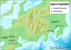
Kyōto, “capital city,” became the common name while Heian-kyō remained a historical designation. Even after warrior governments operated from Kamakura and Edo, the imperial court, noble houses, religious institutions, and many cultural traditions remained centered in Kyoto.
In 1868 the emperor moved to Tokyo, transforming the relationship between the two cities. Modern Kyoto incorporates portions of the ancient plan but extends far beyond it. Discussions of historic capitals should therefore distinguish the eighth-century foundation, the long-lived court city, and the contemporary municipality.
Archaeology, reconstruction, and conservation
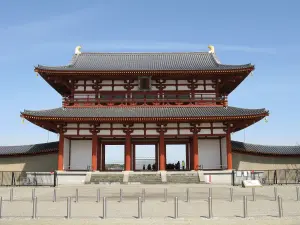
Much of the ancient palace lies beneath modern neighborhoods. Excavated foundations, roof tiles, street traces, documents, and place-names allow researchers to reconstruct particular locations, while museums such as Heiankyo Sousei-kan use large-scale models and digital materials to explain the broader plan.
Only limited elements can be experienced as exposed archaeological sites. Models and later monuments mark historical geography, but they are not surviving eighth-century streetscapes. Conservation must balance buried remains with the needs of a densely inhabited modern city.
Sources
Last updated: