Historic Cities
Tokyo
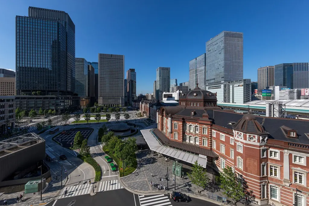
Image: Basile Morin / Wikimedia Commons · CC BY-SA 4.0
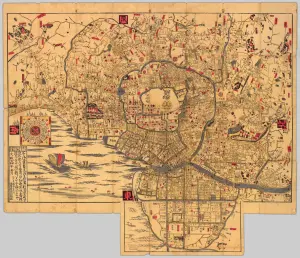
Tokyo is Japan’s capital and a metropolitan prefecture on the Kantō plain. Its political center developed from Edo, the castle town from which the Tokugawa shogunate governed Japan beginning in 1603. Edo was renamed Tokyo in 1868 as the new Meiji government and the imperial court established themselves there. Earthquake, fire, war, reconstruction, railways, land reclamation, and rapid growth repeatedly remade the city, yet rivers, roads, districts, festivals, gardens, and the former Edo Castle still reveal older layers. Tokyo is not a single municipality: the Tokyo Metropolis includes twenty-three special wards, cities to the west, and distant islands. “Greater Tokyo” is a still larger urban region crossing prefectural boundaries. This article focuses on the historic urban center and the metropolitan structure that grew around it.
Overview
| Japanese name | 東京都 |
|---|---|
| Romanization | Tōkyō-to |
| Region | Kantō |
| Historical name | Edo |
| Political transition | Edo renamed Tokyo in 1868 |
| Administrative form | A metropolis containing 23 special wards, 26 cities, towns, villages, and island communities |
Name, geography, and scope
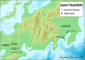
Tokyo means “eastern capital.” The urban core faces Tokyo Bay and spreads across lowlands formed by rivers and uplands cut by valleys. Waterways, plateaus, reclaimed shores, and former moat lines continue to shape streets, rail routes, parks, and neighborhood identities.
Tokyo City existed as a municipality from 1889 to 1943, but it no longer does. The twenty-three special wards occupy much of that former city, while the Tokyo Metropolitan Government also administers western Tama and island chains extending far into the Pacific. Statistics for the wards, the metropolis, and the multi-prefecture Greater Tokyo region therefore describe different areas.
Edo and Tokugawa government
Tokugawa Ieyasu entered Edo in 1590 and established the shogunate there in 1603. The enlargement of Edo Castle, construction of moats and canals, and organization of warrior, merchant, artisan, and religious districts made Edo the political center of Tokugawa Japan while the emperor remained in Kyoto.
Nihonbashi became a reference point for highways and commerce, and waterways moved people, building materials, food, and waste. Daimyō attendance in Edo supported a large service economy and wide cultural circulation. By the eighteenth century the city’s population was among the world’s largest, although estimates and administrative boundaries vary.
From Edo to capital Tokyo
The Tokugawa government ended in 1868. Edo was renamed Tokyo, Emperor Meiji moved from Kyoto, and the former shogunal castle became the Imperial Palace. Government offices, military grounds, factories, schools, banks, and transport infrastructure transformed the inherited city.
The change was neither an instant replacement of Edo nor a simple transfer of every capital function on one day. Old street patterns, property lines, occupations, and communities continued while new national institutions accumulated. Tokyo’s modern capital status is best understood as a political and urban process.
Disaster, war, and rebuilding
The Great Kantō Earthquake of 1923 caused fire and destruction across Tokyo and Yokohama. Reconstruction widened roads, rebuilt bridges, created parks, and altered land use, while residents and businesses also rebuilt through local initiatives. The changes were substantial but uneven.
Air raids in 1945 again destroyed large parts of the city and killed many civilians. Postwar rebuilding, rapid economic growth, the 1964 Olympics, and later redevelopment produced new railways, expressways, high-rise districts, and suburbs. Each phase preserved some earlier fabric and erased or displaced other parts.
Districts, infrastructure, and urban form
Tokyo’s districts are joined by overlapping JR, subway, and private-railway networks. The broader history and operating structure are introduced in Japanese Trains.
Everyday movement through this network changed with Suica, the JR East contactless fare system launched around greater Tokyo in 2001 and later extended into mobile devices, retail payment, and nationwide IC-card interoperability.
Marunouchi, Nihonbashi, Ginza, Asakusa, Ueno, Shinjuku, Shibuya, and other districts developed through different combinations of castle land, temple precincts, commerce, rail terminals, entertainment, and planning. “Old Tokyo” is therefore not confined to one preserved quarter.
The rail network created multiple centers rather than a single downtown. Rivers and canals remain important for flood control, transport, recreation, and memory, even where roads or buildings cover former waterways. The Imperial Palace grounds preserve the main area of former Edo Castle within the modern center.
Culture and everyday life
Kabuki, ukiyo-e, publishing, seasonal festivals, food cultures, and neighborhood associations connect modern Tokyo with Edo, but none has remained unchanged. Migration from across Japan and abroad has continually reshaped language, labor, worship, fashion, music, and food.
Museums, archives, historic gardens, surviving buildings, archaeological sites, and local festivals preserve different kinds of evidence. Contemporary architecture, design, popular media, universities, and small workshops are also part of Tokyo culture rather than departures from an otherwise fixed tradition.
Reading the present city
Shinjuku shows how a former Edo post town became a railway-centered commercial district, entertainment landscape, special ward, and metropolitan administrative center.
Tokyo is simultaneously a national capital, regional economy, collection of local communities, and home to millions of residents. The metropolitan government, special wards, municipalities, and national agencies have different responsibilities, so “Tokyo decided” can conceal which institution acted.
A useful historical route follows one system—water, rail, castle boundaries, religious sites, or rebuilding—across several districts. This reveals continuities that a checklist of landmarks misses and keeps residential streets, working infrastructure, and community rules in view.
Sources
Last updated: