Cultural Geography
Typhoons in Japan
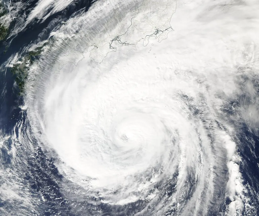
Image: MODIS Land Rapid Response Team, NASA GSFC / Wikimedia Commons · Public domain
Overview
A storm has a track. Its impacts have a landscape.
Typhoons are tropical cyclones that form over the western North Pacific and South China Sea and can bring strong winds, heavy rain, high waves and storm surges to Japan. They are most frequent near Japan from summer into autumn, although the wider basin has storms outside that period. Their effects depend on the storm’s track and structure as well as local terrain, rivers, coastlines and exposure. A national landfall count therefore describes only one part of Japan’s experience. Japanese usage of taifū also covers some storms that English-language meteorological classifications call tropical storms. Understanding the terminology helps readers distinguish seasonal climate, a particular forecast and the historical record of disasters.
Wind and rain travel within a changing cyclone.
Frequency rises in summer and autumn.
Rivers, slopes and coasts shape the local impact.
At a glance
- Japanese term
- 台風 · taifū
- Basin
- Western North Pacific and South China Sea
- Busiest period near Japan
- July–October
- 1991–2020 annual averages
- 25.1 formed; 11.7 approached Japan; 3.0 made landfall
- Primary hazards
- Wind, heavy rain, high waves and storm surge
- Important distinction
- Landfall is a specific statistical definition
01
Taifū and “typhoon” use different thresholds
The Japan Meteorological Agency’s Japanese definition of taifū begins at a maximum sustained wind speed of about 17 metres per second, or 34 knots. Its English classification reserves typhoon for 64 knots or more, with tropical storm and severe tropical storm below that. An English report and a Japanese announcement can therefore use different labels for the same cyclone. Wind averaging conventions must also match before figures from different agencies are compared.
02
Seasonal averages describe frequency, not a forecast
JMA’s 1991–2020 normals show that formation, approach and landfall are most frequent between July and October. Tracks change as the subtropical high and steering winds shift. Late-summer storms can take irregular routes; autumn tracks may curve towards Japan and interact with the autumn rain front. These are climatological patterns, not a prediction of where an individual storm will go.
03
Formation, approach and landfall answer different questions
The three headline counts have different geographical meanings. JMA counts an approach when a storm’s centre passes within 300 kilometres of a Japanese meteorological station. Landfall means its centre reaches the coast of Hokkaidō, Honshū, Shikoku or Kyūshū. A storm crossing an Okinawan island is therefore not counted in this particular mainland landfall statistic.
Formation
- 1991–2020 annual mean
- 25.1
- What is counted
- Cyclones reaching the Japanese taifū threshold in the basin.
Approach
- 1991–2020 annual mean
- 11.7
- What is counted
- Centres within 300 km of a Japanese meteorological station.
Landfall
- 1991–2020 annual mean
- 3.0
- What is counted
- Centres reaching the coast of one of the four main islands.
04
Wind, rain and the sea create different kinds of damage
Strong winds can affect buildings and infrastructure, while rain can cause river flooding and slope failures. Coastal effects include high waves and storm surge. JMA explains storm surge through the rise in sea level associated with low pressure and wind-driven water accumulation. The shape of a bay and the direction of the wind can amplify the result. A location’s hazard cannot be inferred from wind speed alone.
Wind
- Physical process
- Strong moving air and gusts
- Relevant local setting
- Exposed buildings and infrastructure
Rain
- Physical process
- Intense or persistent precipitation
- Relevant local setting
- River basins and slopes
Storm surge
- Physical process
- Abnormally elevated coastal water level
- Relevant local setting
- Low-lying coasts and bays
High waves
- Physical process
- Large wind-generated waves
- Relevant local setting
- Open coasts and harbours
05
Historical storms connect weather with places
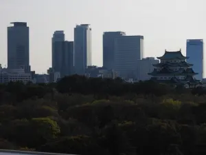
The Isewan Typhoon of 1959 is closely associated with the Ise Bay region, including the area around Nagoya. Digital Typhoon’s Historical Disaster Database links disaster records with weather maps and historical administrative geography. This helps distinguish a cyclone’s meteorological path from the local record of flooding, destruction and recovery. Historical boundaries and reporting practices also matter when comparing events.
06
Use this overview alongside current official information
This entry describes the phenomenon and its cultural-geographical context. Current conditions require the latest JMA information and local authority announcements. A forecast track depicts one aspect of the storm; rainfall and coastal impacts may extend beyond the centre’s projected route. Seasonal averages, photographs of past storms and historical disaster accounts should never be mistaken for a live warning.
Sources
Last updated: